
Wednesday, February 10, 2010
Haiti Earthquake Response Map
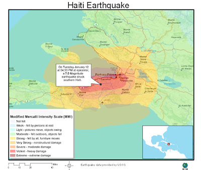
Below is a map I found while browsing the web for Haiti GIS maps. The map is from Esri and it displays the Modified Mercalli Intensity measurements for the areas surrounding the affected region. This map is helpful in showing where the most intesity was felt and the relation to major cities in Haiti.
Subscribe to:
Post Comments (Atom)
No comments:
Post a Comment