Below are links to my final project presentation and write-up regarding the Bobwhite-Manatee Transmission Line Project. I really liked this final as it helped tie together many of the things we learned over the semester. I have a much better understanding of GIS and its application after this semester.
http://students.uwf.edu/ojy1/Bobwhite-Manatee_Project_Report.pdf
http://students.uwf.edu/ojy1/Bobwhite-Manatee_Project_Presentation.pptx
Monday, April 26, 2010
Tuesday, April 6, 2010
Week 11 Lab - Module 1 3D Analyst
Week 11 Lab - Module 1 Spatial Analyst
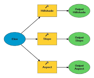
Image 3. Model Builder


The model builder is a neat tool, it is awesome that you can build a model with graphics and then run the model from that graphic interpretation.

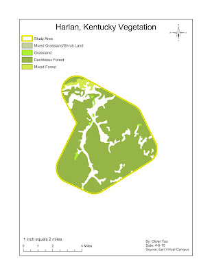
Map 4. Vegetation Reclassification
Again, this was an educational exercise that showed how powerful some of the arc toolbox items can be in making work easier.

Week 11 Lab - Module 1 Labels and Annotations
Subscribe to:
Comments (Atom)


