Here is my map of the top four largest landowners in Gulf County. This lab was fun to do. I had a hard time finding the County outline, roads, and hydrology.
Monday, March 29, 2010
Saturday, March 20, 2010
Vector Analysis II Lab
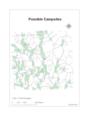
1. Which tool did you use? Intersect
Was there any noticeable difference between its results and the results from the instruction? No, in both cases I had 4 matches. However, the resulting maps were different. The intersect only displayed areas water and road buffer overlapped.
2. Which tool did you use here and why? Erase overlay since I wanted to exclude the conservation areas from my search
3. How many features are in this layer? 79 features
What is the area of the largest feature? 7,765,034 sq meters
What is the area of the smallest feature? 748 sq meters
Monday, March 1, 2010
Lab 6 UWF Campus Edited
Subscribe to:
Posts (Atom)